Track prediction of Tropical Storm Surigae (formerly 91W) by 60km MPAS
Which matters more for 91W’s track, DA or the NWP model?
In my previous post, I mentioned that for forecasts initialized from 2026-09-22T12, all NWP models (GFS, ECMWF, CMC, ICON) did not predict that 91W (now Tropical Storm Surigae) will go northward in front of taiwan, while DLWP models, Google’s WN-cyclone and ECMWF’s AIFS predict that 91W will make the turn. (check those forecasts at https://www.tropicaltidbits.com/)
For the forecast initialized at 2026-09-23T18, ECMWF’s NWP model started to predict that 91W will turn around in front ot Taiwan, agreeing more with the DLWP model predictions.
By contrast, GFS did not. For the cycle initialized at 2026-09-23T18, GFS still predicted that 91W would approach northern Taiwan and then move southwards, due to the interaction with the other approaching storm on its east.
Since I’m running a low-resolution (60km) global MPAS routinely and working on data assimilation, I care about whether it is the initial condition or the NWP model that contributes more to this track prediction.
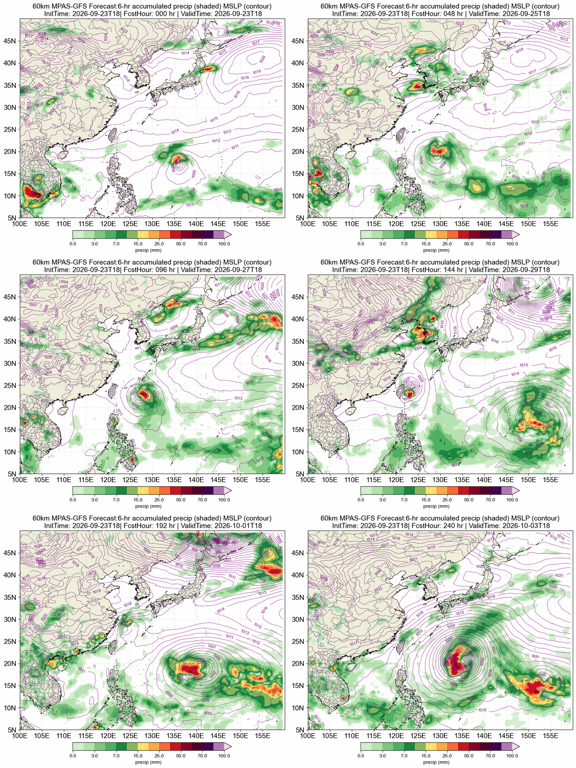
60km MPAS initialized from the GFS analysis at 2026-09-23T18
For the 60km MPAS initialized from the GFS analysis at 2026-09-23T18, 91W will approach northen Taiwan and continue going more northwards. While it has already moved relatively more west (124E) than EC’s prediction (which goes up around 128E), its track prediction is closer to ECMWF’s and those DLWP models. Due to its long distance from the approaching storm, 91W has not move southwards when it approched Taiwan.
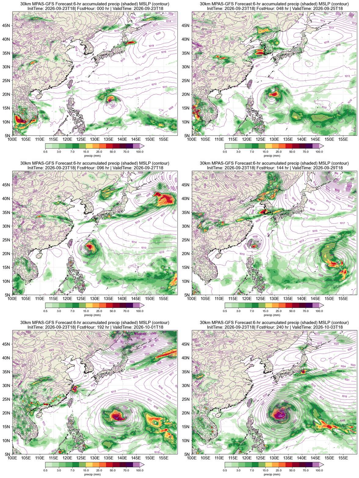
30km MPAS initialized from the GFS analysis at 2026-09-23T18
One question is: does the model resolution of 60km too coarse that it influences the move speed of those storms, so their interactions were too late, contributing to the more “correct” answer? To rule this out, another experiment was conducted using the 30km MPAS. Simliar results are shown here, that its track prediction is pretty consitent with the 60km MPAS prediction.
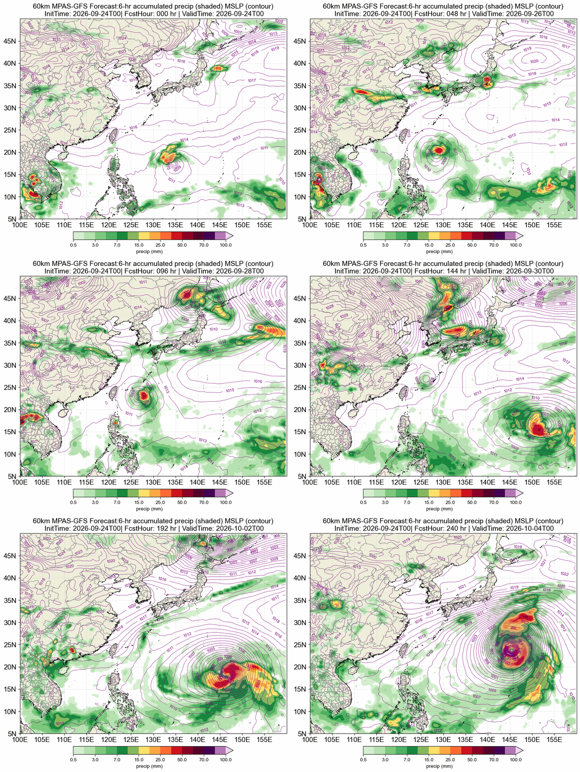
60km MPAS initialized from the GFS analysis & GMAO’s GEOS-FP at 2026-09-24T00
For the 60km MPAS initialized at 2026-09-24T00, it even agreed more with the ECMWF and those DLWP models. It predicts that 91W will deviate in front of Taiwan and move northwards.
By contrast, GFS’s 91W from this cycle is still struggling with its interaction with the other storms. This struggle continued, still being seen in the cycle 2026-09-24T12.
Model problem? Not sure.
Since GFS is based on FV3, I checked NASA GMAO’s GEOS-FP forecasts initialized from 2026-09-24T00, which shares similar dynamical core as the current GFS. As shown below, actually GEOS-FP’s prediction is more close to the ECMWF and my MPAS run. It is worth pointing out that GEOS-FP use its own DA system and observation streams to generate the analysis thus its initial condition is different from the GFS analysis.
It will be interesting if GFS (GEOS-FP) uses the analysis from the GEOS-FP (GFS) as the IC to make a forecast, which can answer more questions.
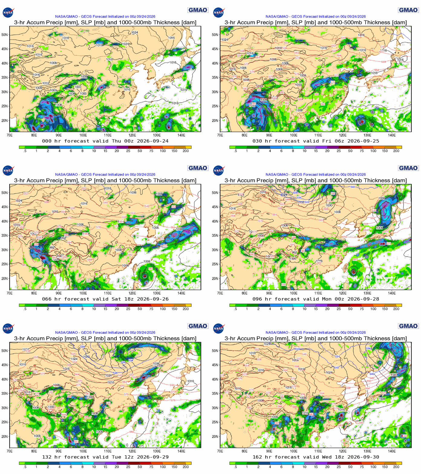
citation: figure downloaded from GMAO’s GEOS-FP website
Some useful links
- My 5-day 3km regional MPAS forecast for Eastern US: https://www.cdalab.org/mpas_chesa/
- My 3-day 60km global MPAS forecast: https://www.cdalab.org/mpas_glb60km/
- NASA GMAO’s forecast products: https://fluid.nccs.nasa.gov/weather/
- TropicalTibits: https://www.tropicaltidbits.com/